

Border Surveillance Map
Disable Stretch:
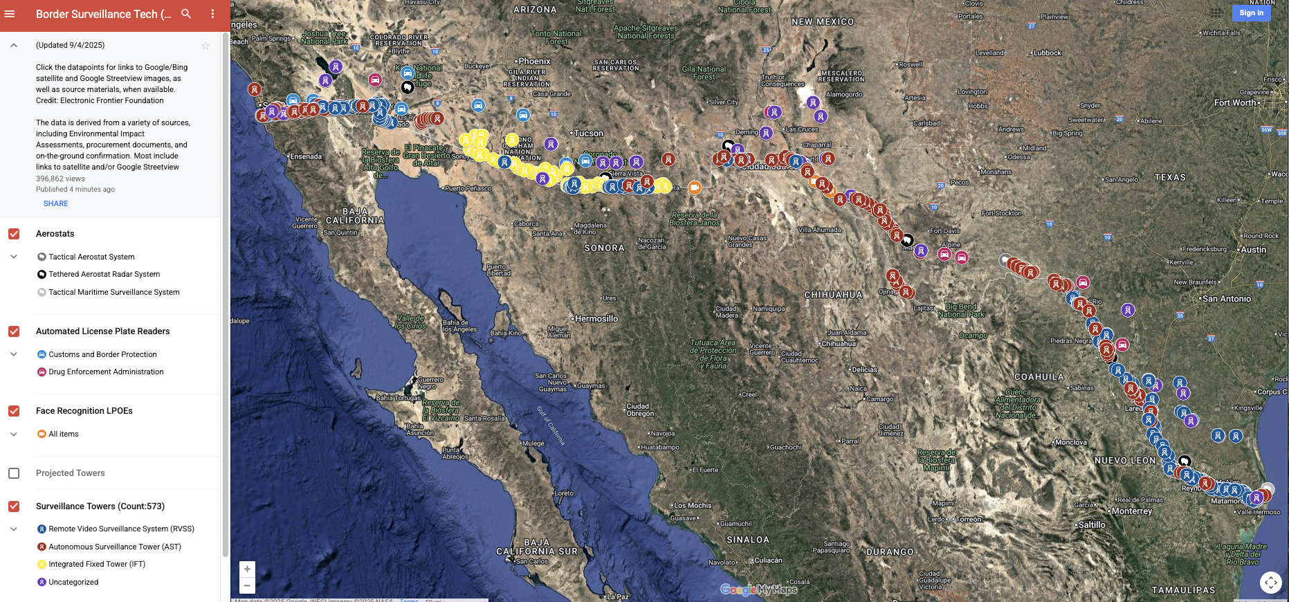
This dataset includes the locations of Customs & Border Patrol surveillance towers, proposed tower locations, automated license plate readers, aerostats, and face recognition at land ports of entry. There is an accompanying blog post and map. This dataset is licensed under a Creative Commons 3.0 Attribution license.
Last updated: June 5, 2026.